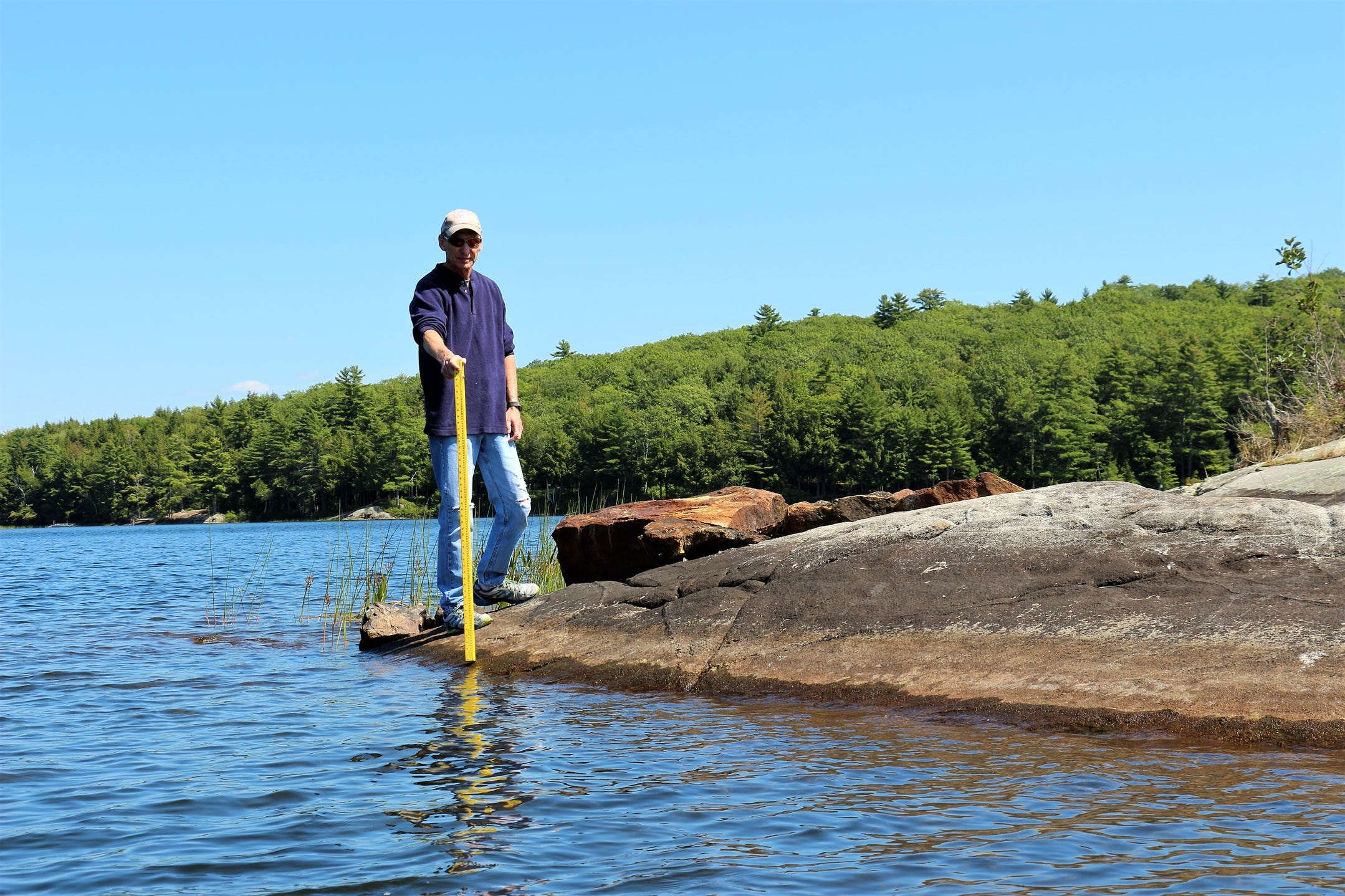
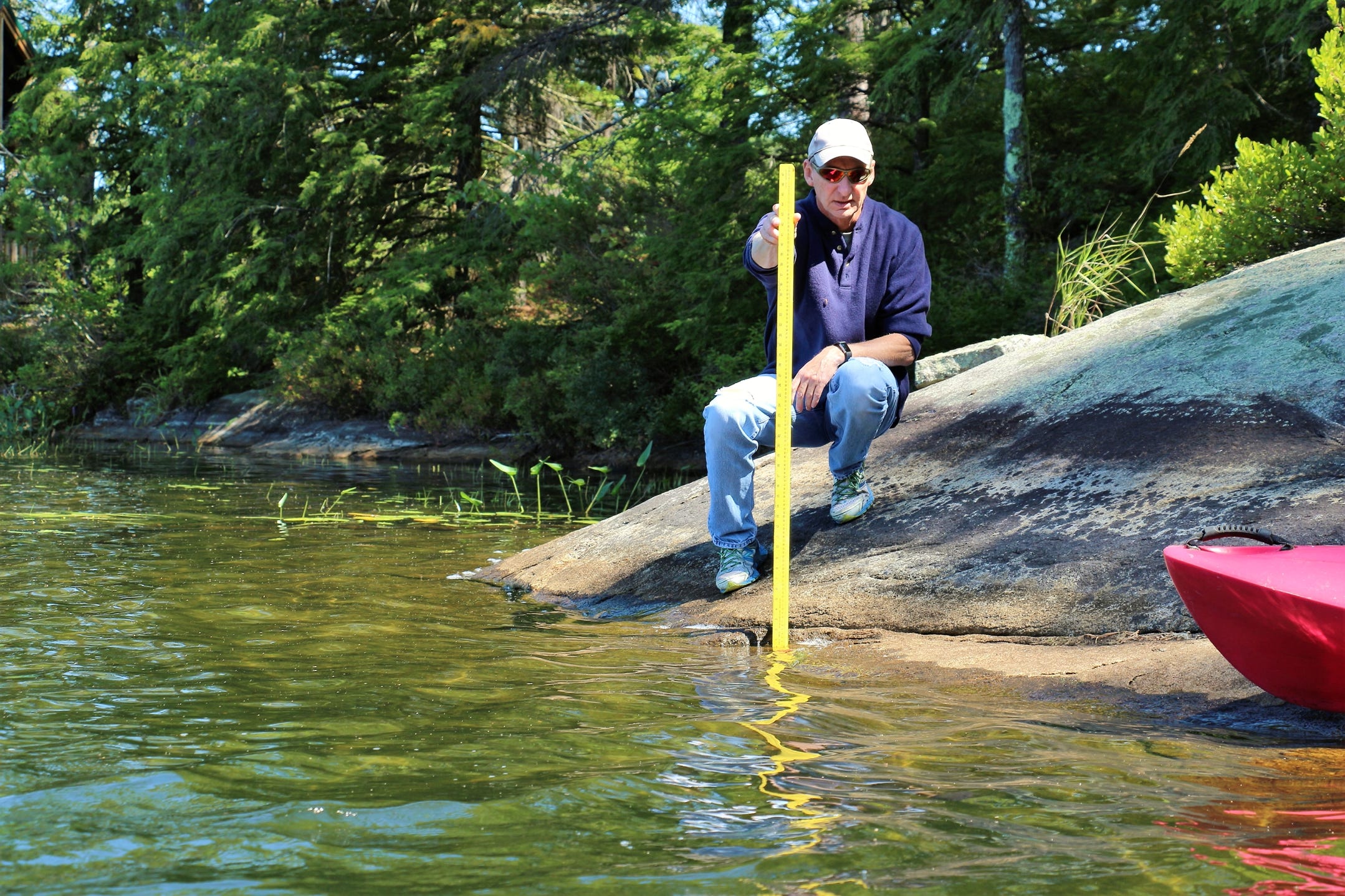
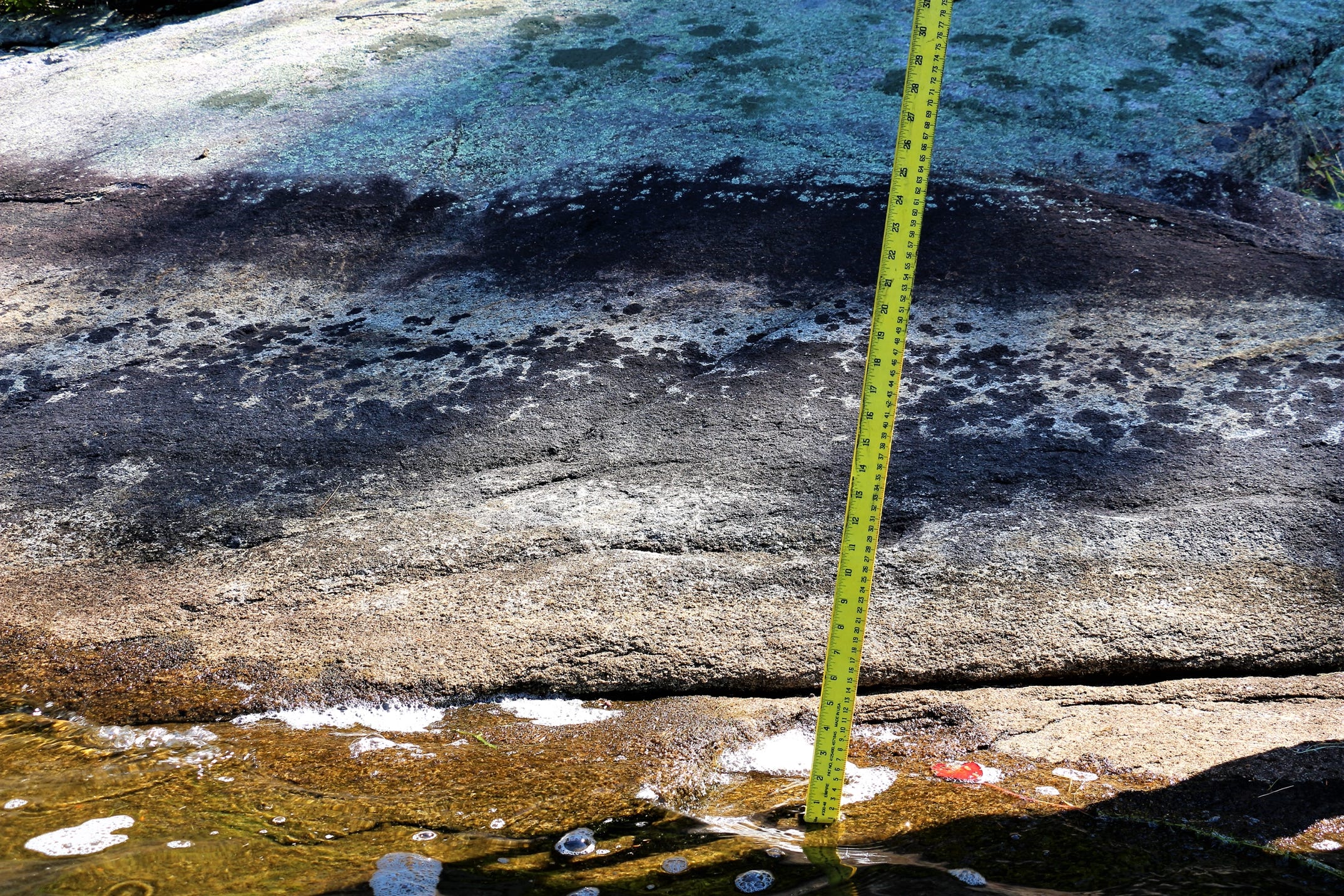
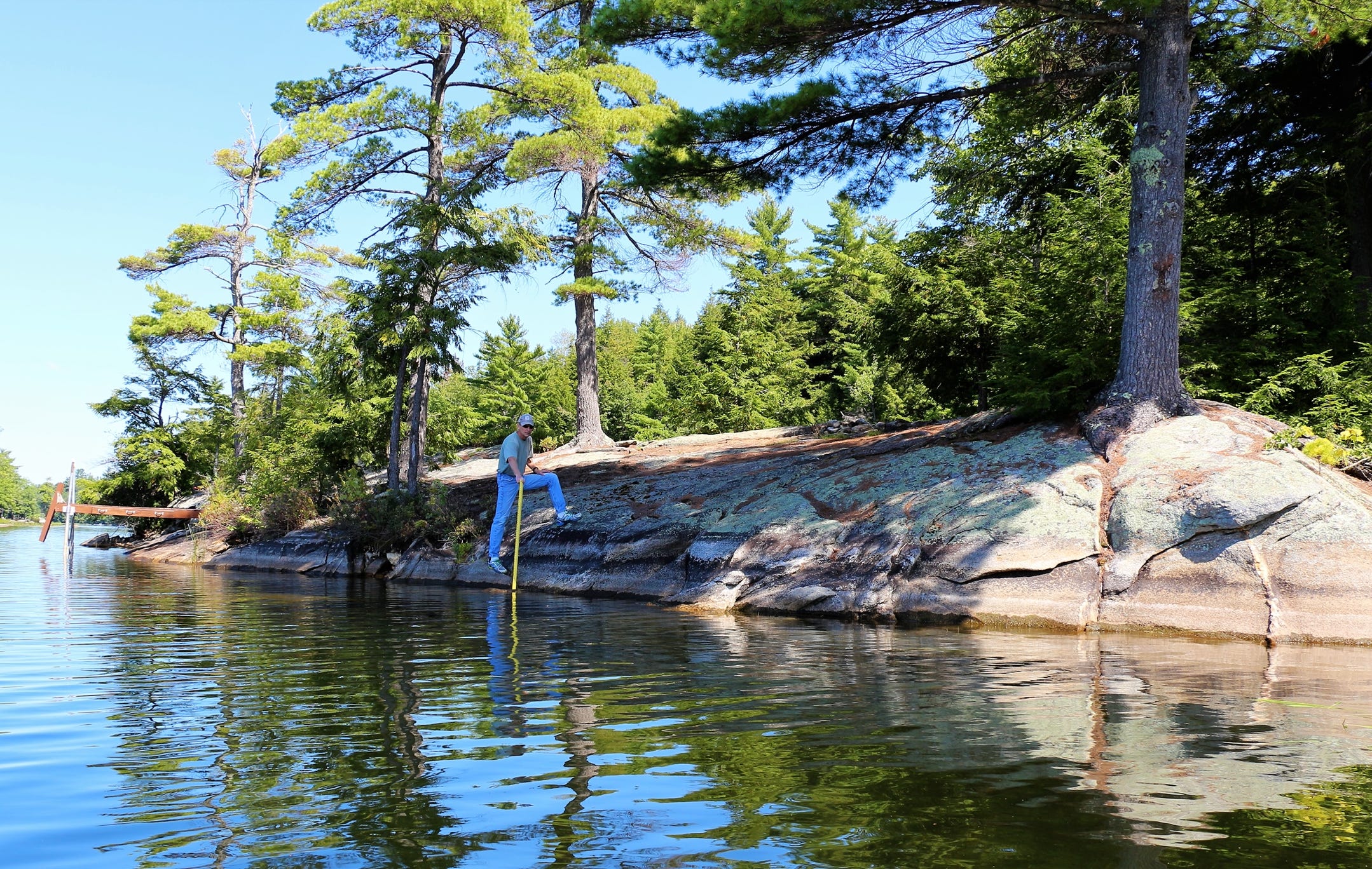
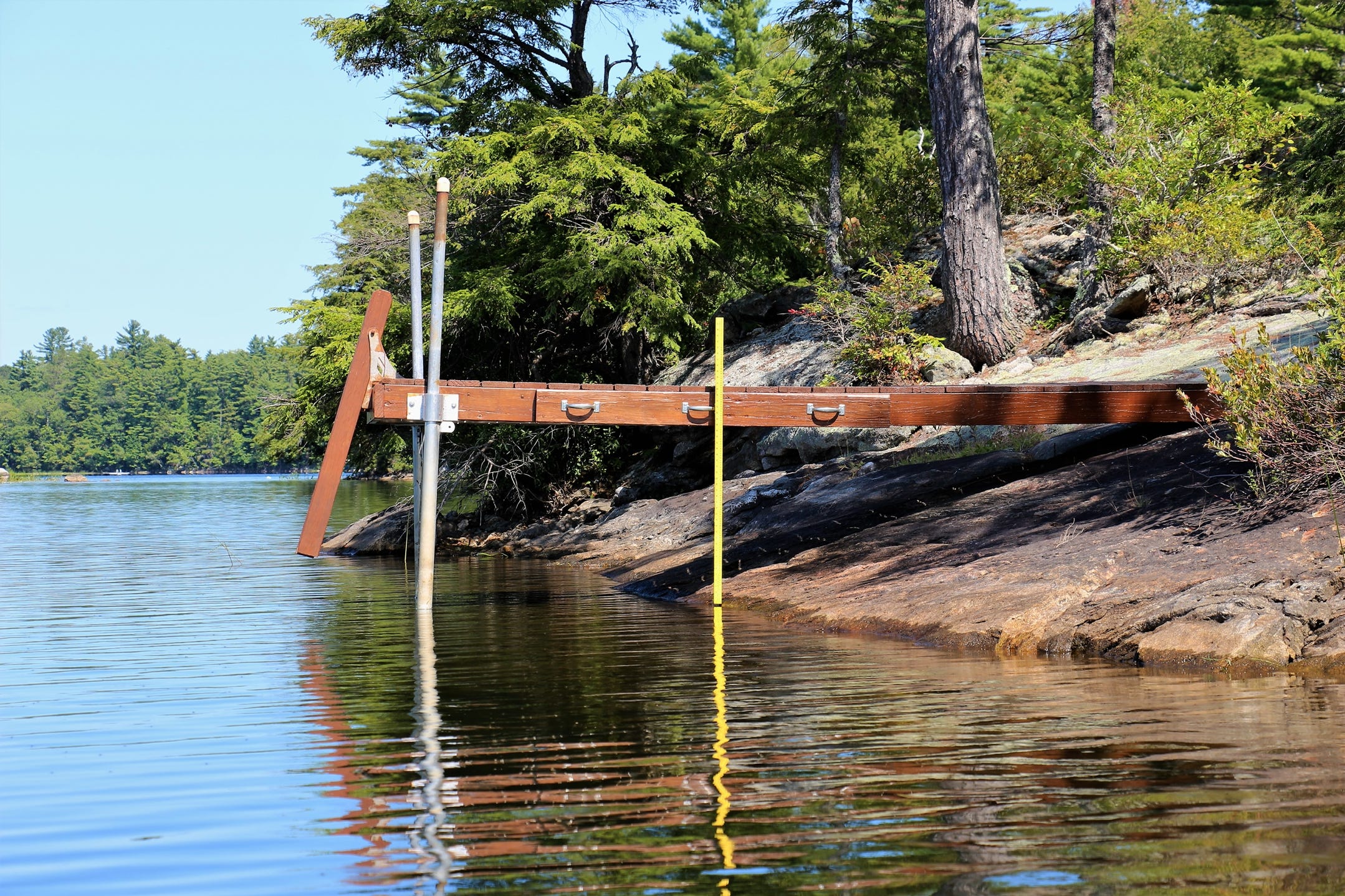
These photos, along with the other historical evidence which has been uncovered, provide proof that a dam has existed for a very long time at the north end of David Pond. Water marks were photographed on a few of the rocks along the shoreline. There are literally hundreds of rocks with these stains around the entire perimeter of the pond. The measuring stick is 48". If you magnify the photo on the measuring stick, you will see the high water mark on the rocks is 25"-30" above the current water line.
These measurements fit exactly with the historical water level data included in USGS topographic maps. 1910, 1912, and 1941 topo maps showed water levels at 393' Mean Sea Level (MSL). The July 2017 water level completed by the surveyor showed the pond at 391' MSL, 2 feet below the historical water level of the pond.
The mill pond just to the south side of Sandy River Road is 6’ MSL below the outlet. Thus, it would be impossible to have water level stains 25"- 30" above the current water level on these rocks if a dam DID NOT exist.